
The Grove Townhomes
This Rezoning request from single-family detached to multi-family attached is located on a 2.5 acre parcel at:
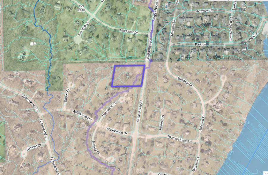
5N024 Route 31
St. Charles, IL 60175
The 2.5 acre property is highlighted in blueish purple.
The purple line running north to south through property represents the WaterShed
Light blue lines represents stormwater flow path.
For more detailed and various diagrams, please visit the Kane County GIS websites at:
KaneGIS4
https://gistech.countyofkane.org/gisims/kanemap/kanegis4_agox.html
KaneGIS3
https://kanegis.maps.arcgis.com/apps/webappviewer/index.html?id=4dbc1814d20c4f65b9a60b4a6671d0cd
The Grove Concept Plan Application submitted to the City of St. Charles Community Development on Friday, April 5, 2024
The Grove Townhomes
City Projects - Business and Development
Project Website
Submitted April 5, 2024
Application 4-5-24.pdf
Adobe Acrobat document [2.8 MB]
Submitted April 5, 2024
REVISED USE THIS EX242075_5N024Rte31Town[...]
Adobe Acrobat document [4.5 MB]
Submitted April 5, 2024
Frontier_Residential_240328_reduced_0.pd[...]
Adobe Acrobat document [963.9 KB]